This analysis provides a regional, sky–level perspective on suitable locations for homes. The model takes an objective view of housing on the landscape by assessing needed features and identify where they overlap. The model incorporates more than 30 landscape features relevant to livability and resilience, including infrastructure, public health, natural resources, wildlife habitat, soil type, recreation, cultural landmarks, and access to services and employment. It is not intended to be prescriptive or exhaustive, nor is it intended to analyze the suitability of an individual parcel of land or identify all existing structures and regulatory requirements. See the appendix for full details on the methodology and datasets.
THE INTENT: Identify land suitable for homes
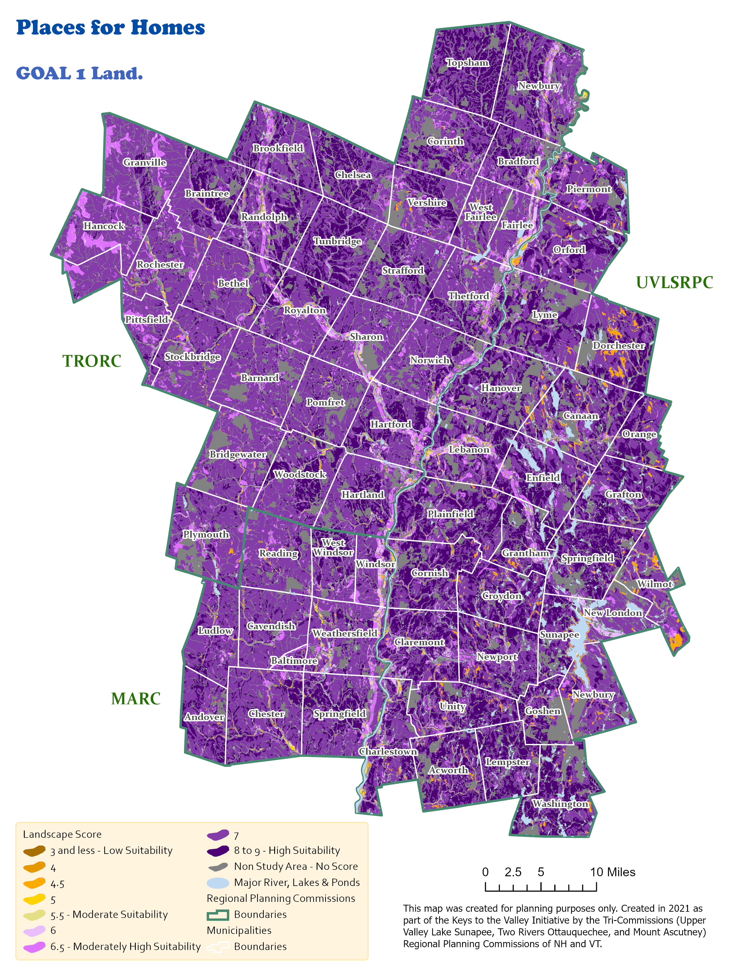
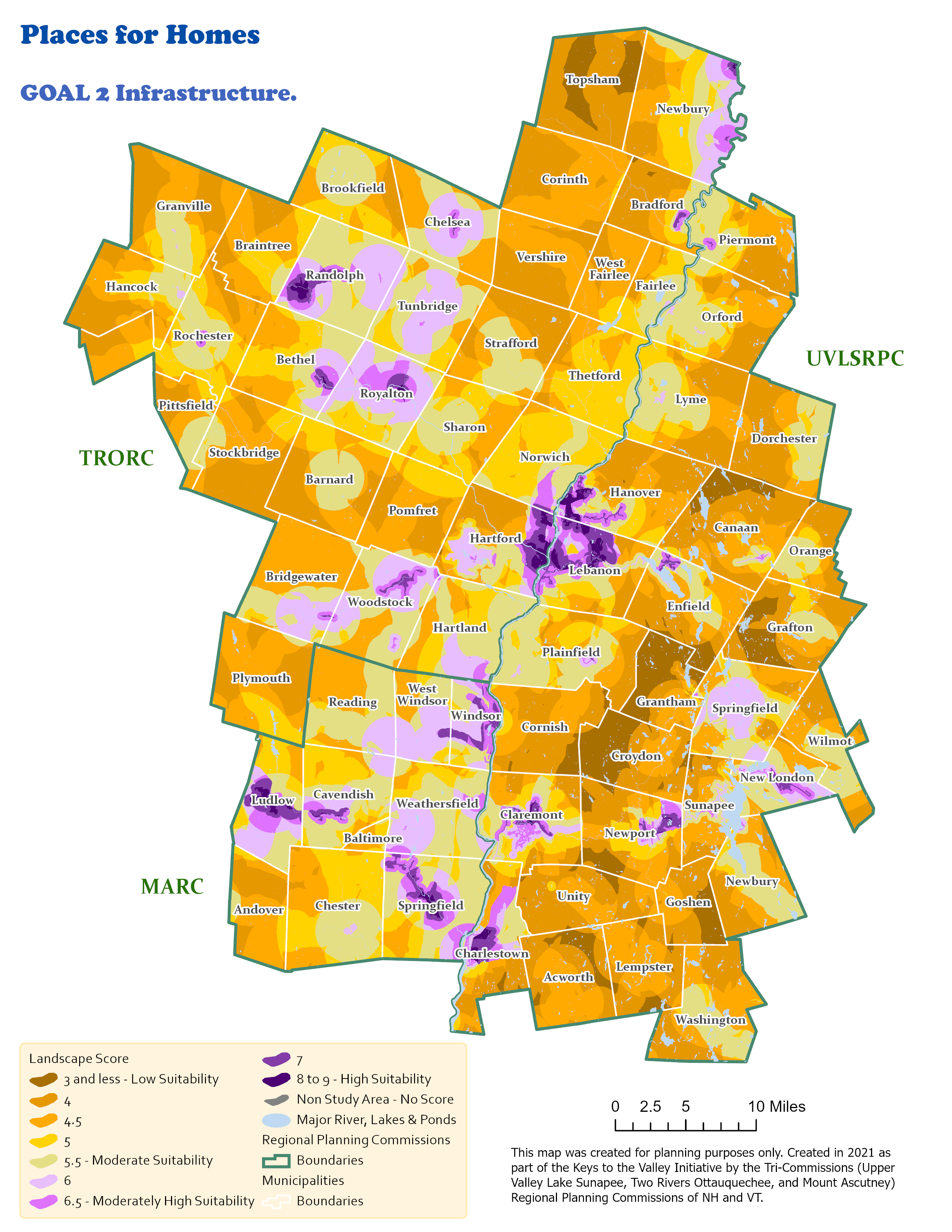
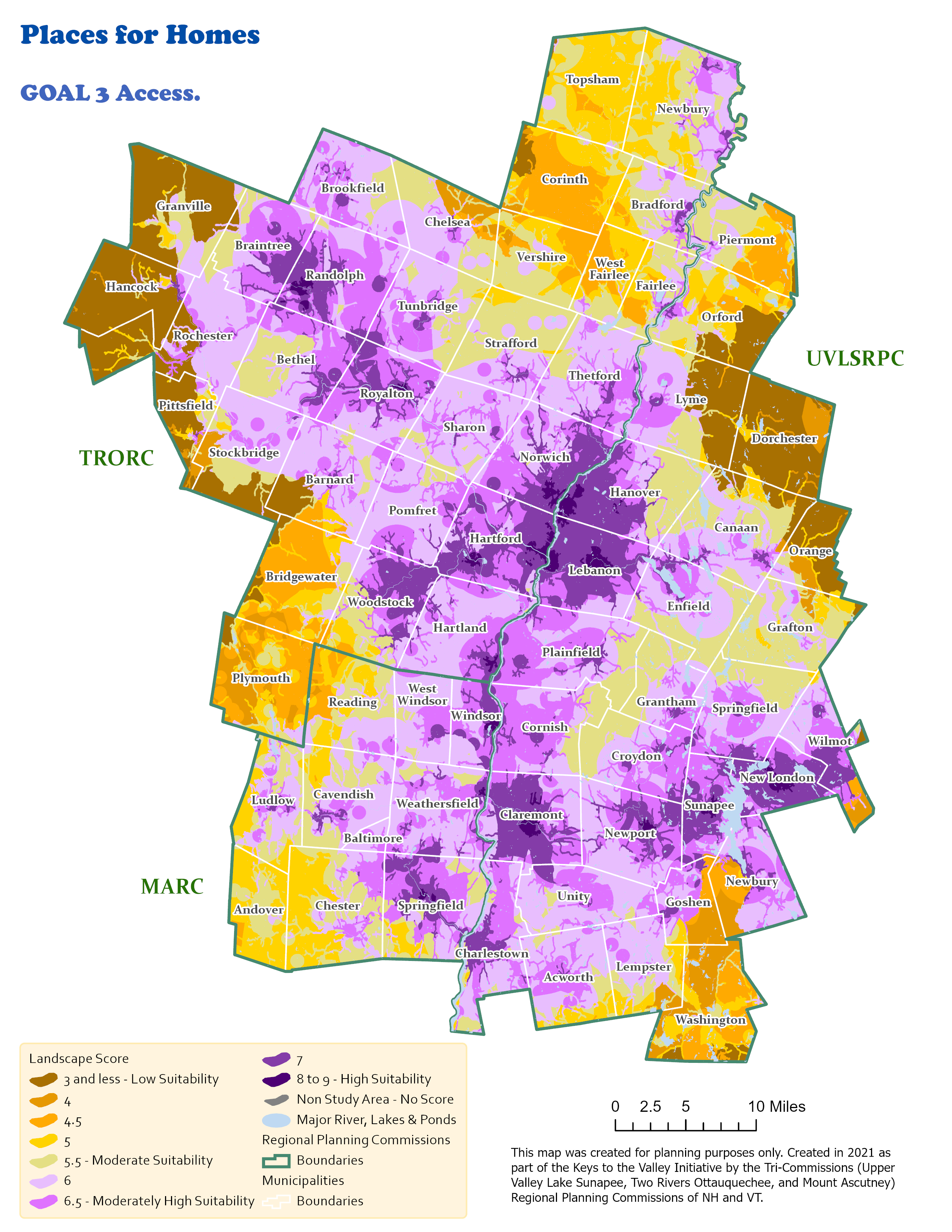
The Homes Landscape is created by a series of goals and objectives (Figure 3) (see Appendix report for detailed maps on each objective).
- Identify appropriate land for residential development
- Physical barriers
- Legal Restrictions
- Protection priority
- Health risk
- Identify areas with existing infrastructure
- Basic services
- Transportation and mobility
- Identify areas that are accessible to services and employment
- Employment
- Education
- Recreation
- Essential Services
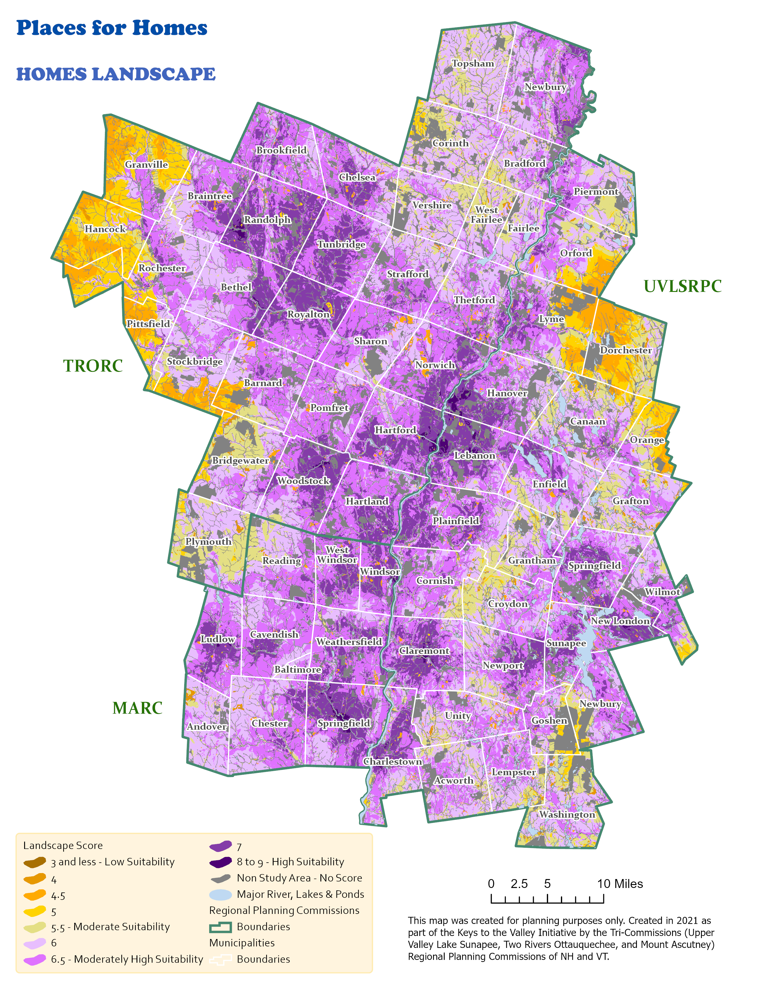
The Homes Landscape (Figure 1) shows the Region using a home suitability scale of 1 (low suitability) to 9 (high suitability). Lands referred to as Non–Study are considered unbuildable in this model and receive no score. These include waterbodies and conservation easements. Overall, the region’s lands are well suited for homes with near 50% of land receiving a high suitability score (between 8 and 9).
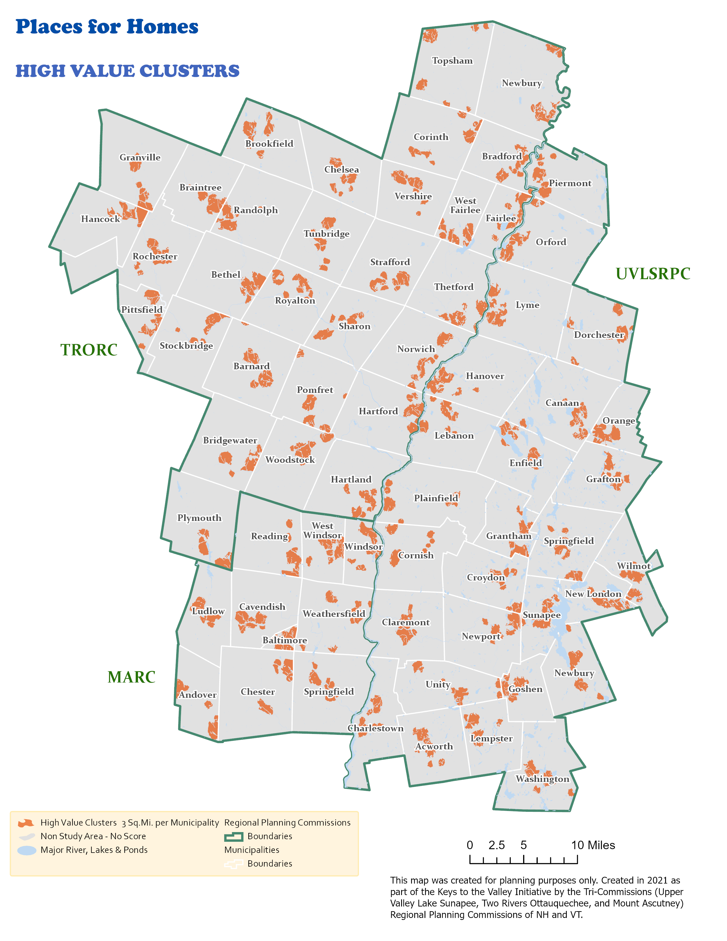
Communities can optimize infrastructure investment by identifying clusters of suitable land for investment. To do this each municipality received 3 square miles of high-scoring areas, with each area being at least half a square mile (Figure 2). These areas or clusters highlight opportunities for infill where infrastructure exists, for focused revitalization efforts, and for cross-community collaboration.
Places for Homes is intended for land use planning and community workshops. Communities can tailor the model and add local knowledge to inform local priorities in partnership with their regional planning commission. The visuals can also be showcased at an event to discuss land use opportunities and tradeoffs. The following resources are available for public use, both virtually and by request.
- Interactive Map – learn, engage, download and make your own community-specific maps
- Training video – learn what you can do on the Keys to the Valley open data portal
- Places for Homes landscape can be requested from your local RPC, including technical assistance
Figures
Figure 1. Homes Landscape suggests the suitability of land for homes. The model takes an objective view of housing on the landscape by assessing needed features and identify where they overlap.
Figure 2. Orange areas represent clusters of high-scoring land in the Homes Landscape resulting in 3 square miles within each municipality.
Figure 3. Landscape scores for each goal that informed the Homes Landscape