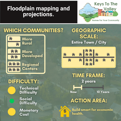
Floodplain mapping is an essential tool in understanding the flood risks of our homes. Reducing this risk involves preventing or limiting development in certain zones. To effectively implement these strategies, communities need accurate information about flood risks.
A central, but incomplete, resource is the flood hazard and risk data from the Federal Emergency Management Agency (FEMA). Communities should use FEMA data to inform policies and management plans, while also acknowledging the limitations of this data. For example, climate change is expected to increase the severity and regularity of intense flooding events. To address this, communities may consider advancing local floodplain studies in specific areas of concern. Another option is to use the FEMA 500-year floodplain to designate flood zones in local policy, rather than the 100-year floodplain (also known as 0.2 and 1 percent annual chance of flooding, respectively). Communities should also track when they are on the docket for an update to their FEMA floodplain maps, and engage with FEMA to ensure that maps are accurate.
Additional Resources: